In the previous tutorial, you learned how to install GeoCode. Here, you'll learn how to use the GeoCode add-on to transform postal addresses into coordinates.
1. Initialize the Geocode add-on wizard
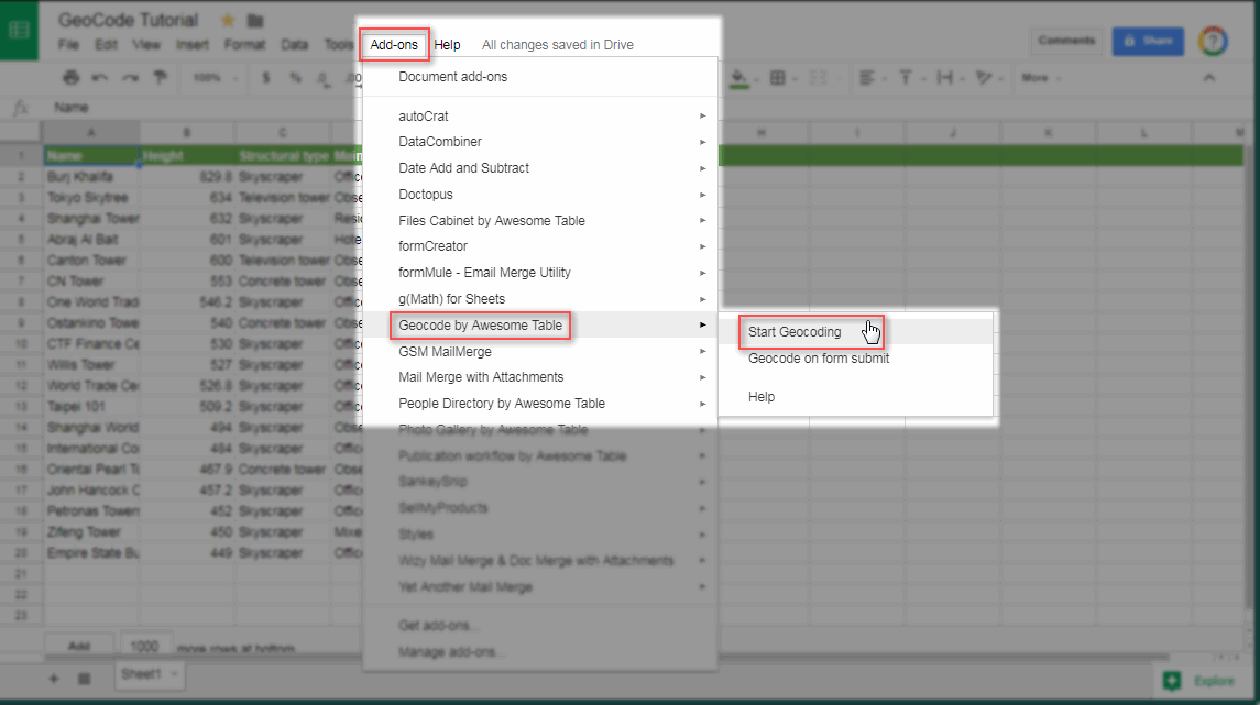
To start using Geocode, open an existing Google Sheets with postal addresses in it. Run Geocode before adding any keywords or filters. From your data sheet, select Add-ons > Geocode by Awesome Table > Start Geocoding.
Image A
2. Configure the address field
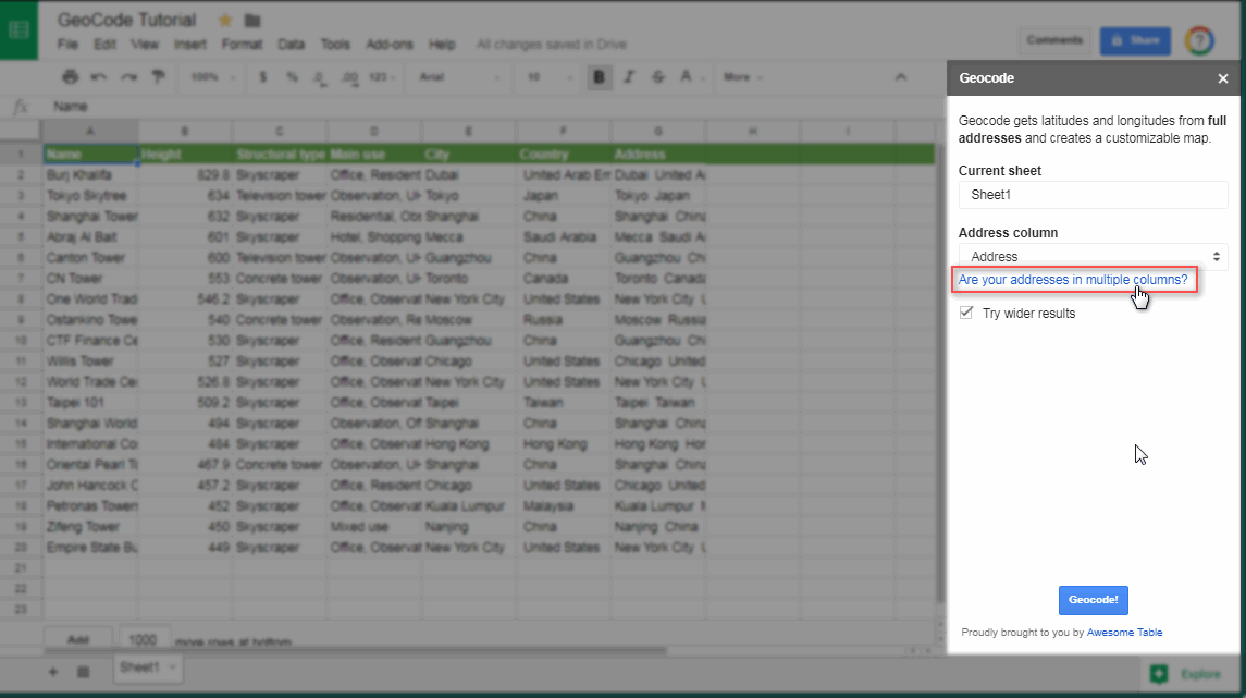
If the complete address is stored in just 1 column, choose the appropriate column name from the dropdown menu under Address column (image B). Otherwise, click Are your addresses in multiple columns? (image C).
Image B
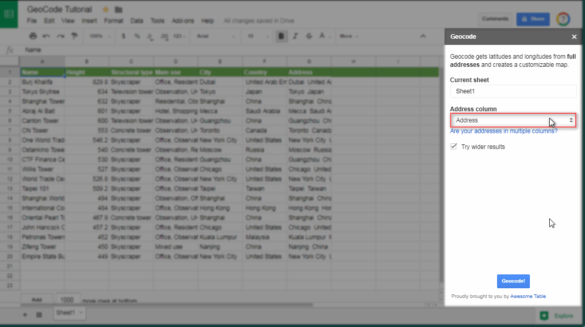
Image C
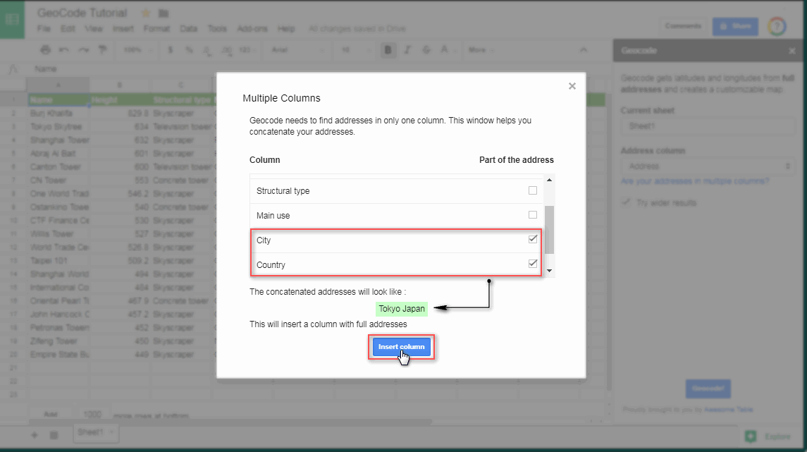
The multiple columns window shows the column names on the left and checkboxes on the right. You simply need to check the boxes where your separate address fields are stored (image D). Then, click the Insert column button.
Image D
This will create a new column labeled Full Address right next to the country column - containing the concatenated values of the address fields you checked earlier (image E).
Image E
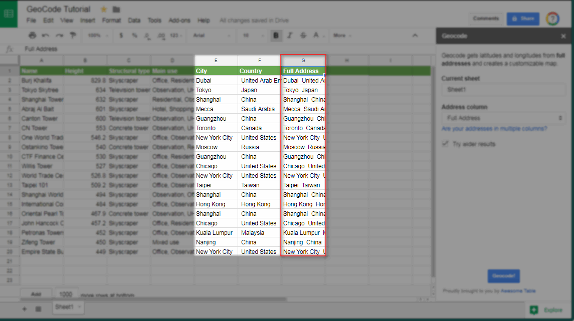
Make sure that the Try wider results checkbox is checked:
3. Start Geocoding
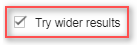
Now click the Geocode! button (image F) to transform your addresses into coordinates.
Image F
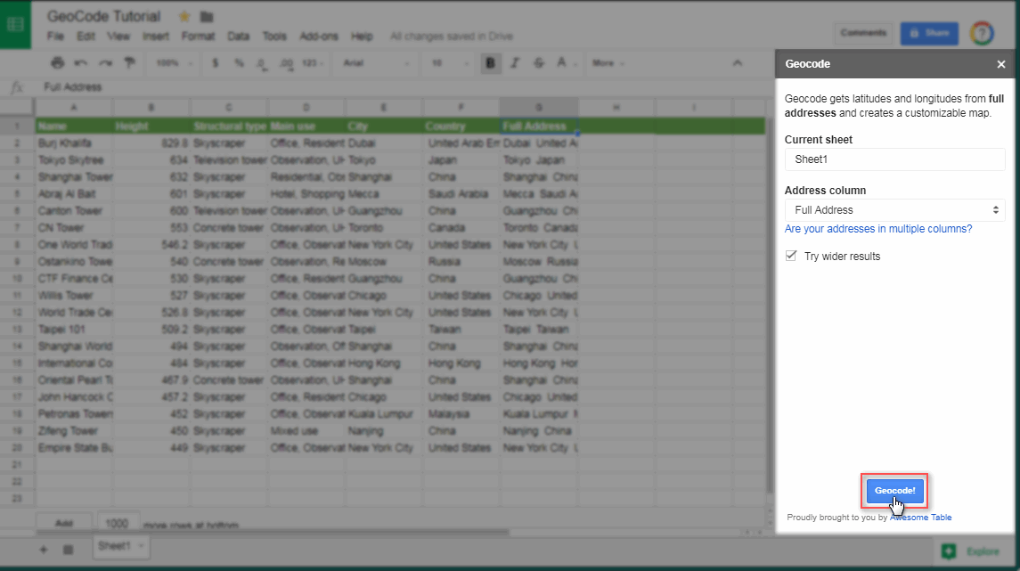
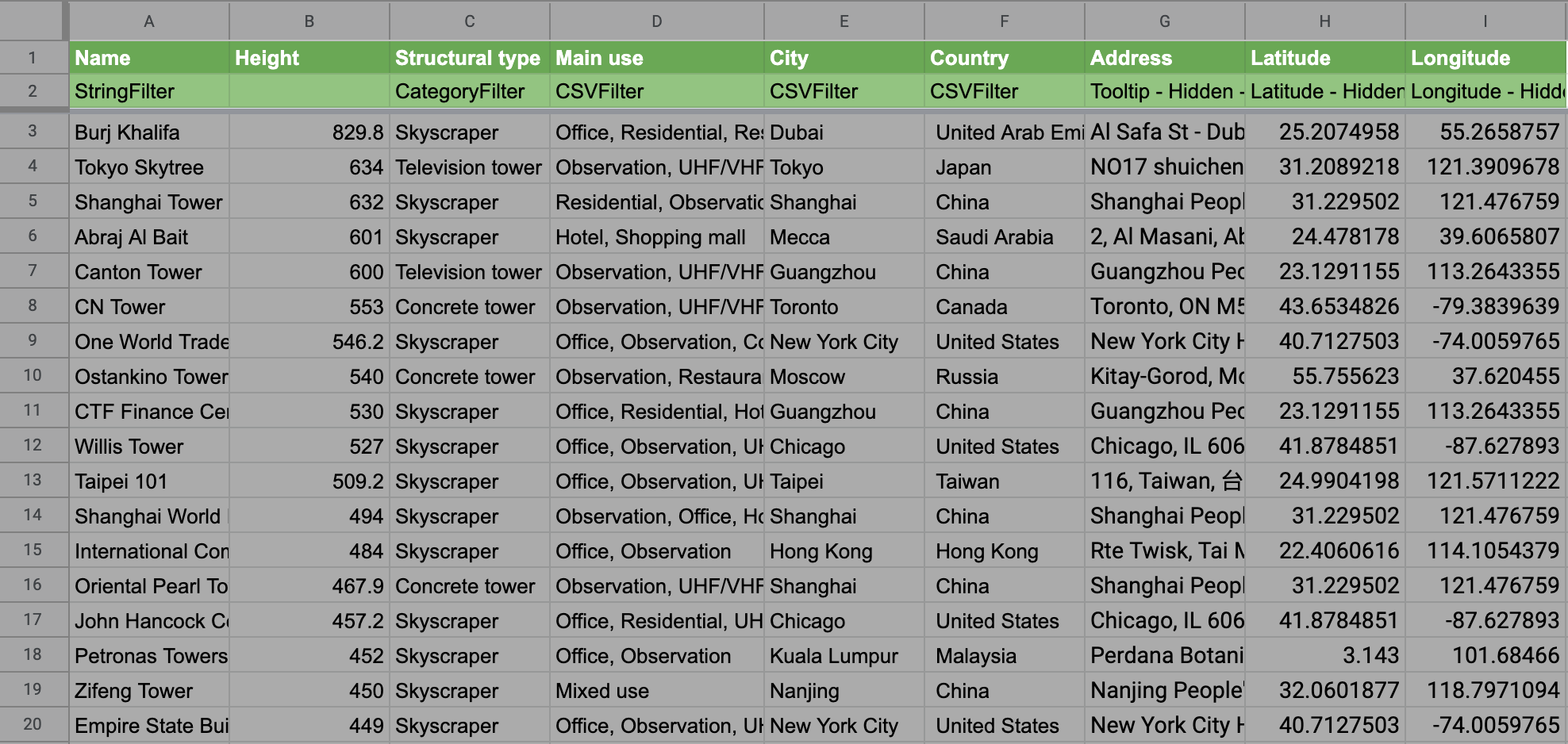
After the script executes, two new columns will be added immediately after the Address column: Latitude and Longitude (image G) .
Image G
4. Create your interactive Map
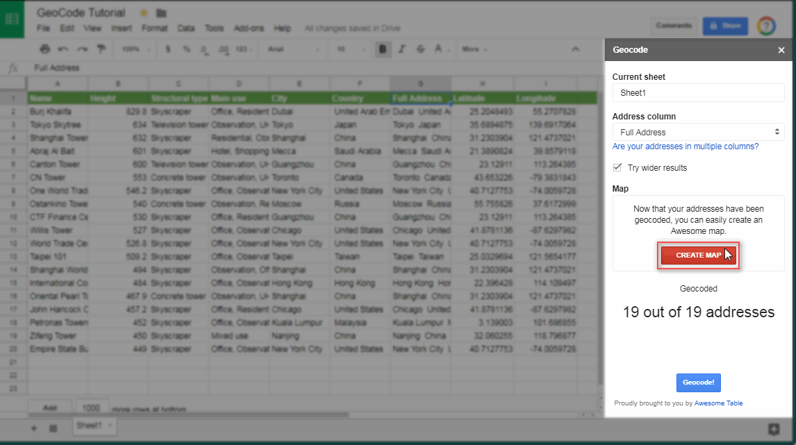
Finally, click the Create Map button (image H).
Image H
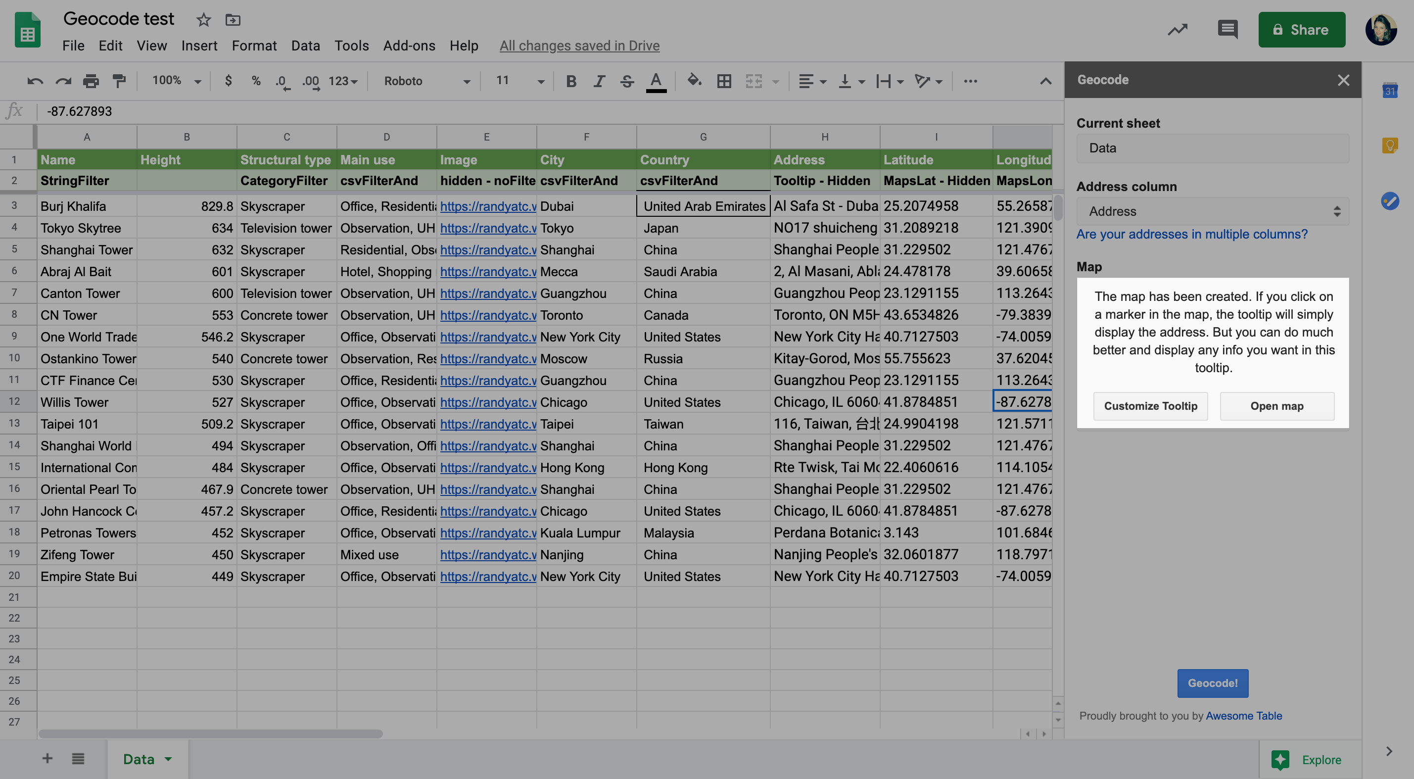
A new row is created on your datasource. This row is for filters and keywords (image I). Geocode automatically generate your Awesome Table app using the Map visualization type.
Image I
Read our filter article to know more.
Geocoding phase: Complete.
You are now presented with the settings (optional) to: Customize the Tooltip or Open the Map app (image J). For now, choose Open map to see the default app.
Image J
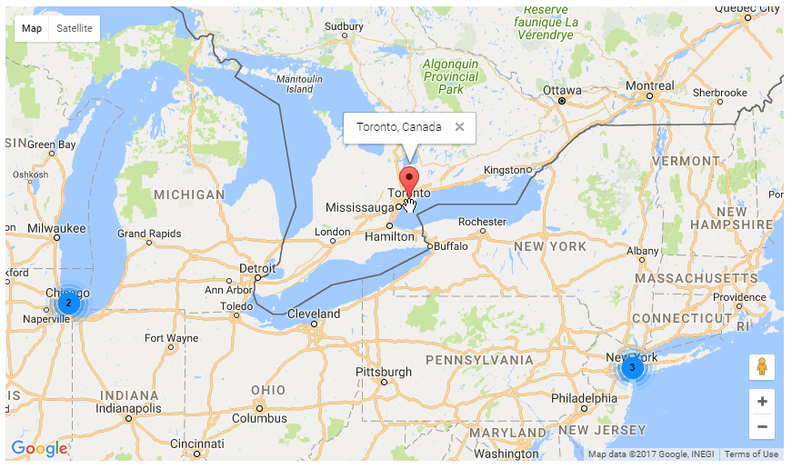
When you click on any marker, you'll be presented with a plain-vanilla tooltip displaying the city and the country (image K). You can choose to accept this default or you could further customize your Tooltip to enhance it.
Image K
In this tutorial, you learned how to use the GeoCode add-on to transform your addresses into coordinates.
In the next tutorial, you'll learn how to Customize the Tooltip.